The purpose of this blog post is to highlight some of the interesting and/or beautiful places on Shetland Mainland, which are not mentioned in most guidebooks. These include beaches, gardens, ruined buildings, memorials, burns, unusual geology, coastal cliffs and works of art. I discovered most of them thanks to Shetland geocachers, who had thoughtfully placed geocaches nearby.
The wording on this plaque at the Bay of Scousburgh is as follows:
"In memory of the crew of the brig 'Starke' shipwrecked in Trae Geo March 1822. Six members of the crew are buried here."
The grid reference is HU 369 180
Beautiful beach at Bay of Scousburgh
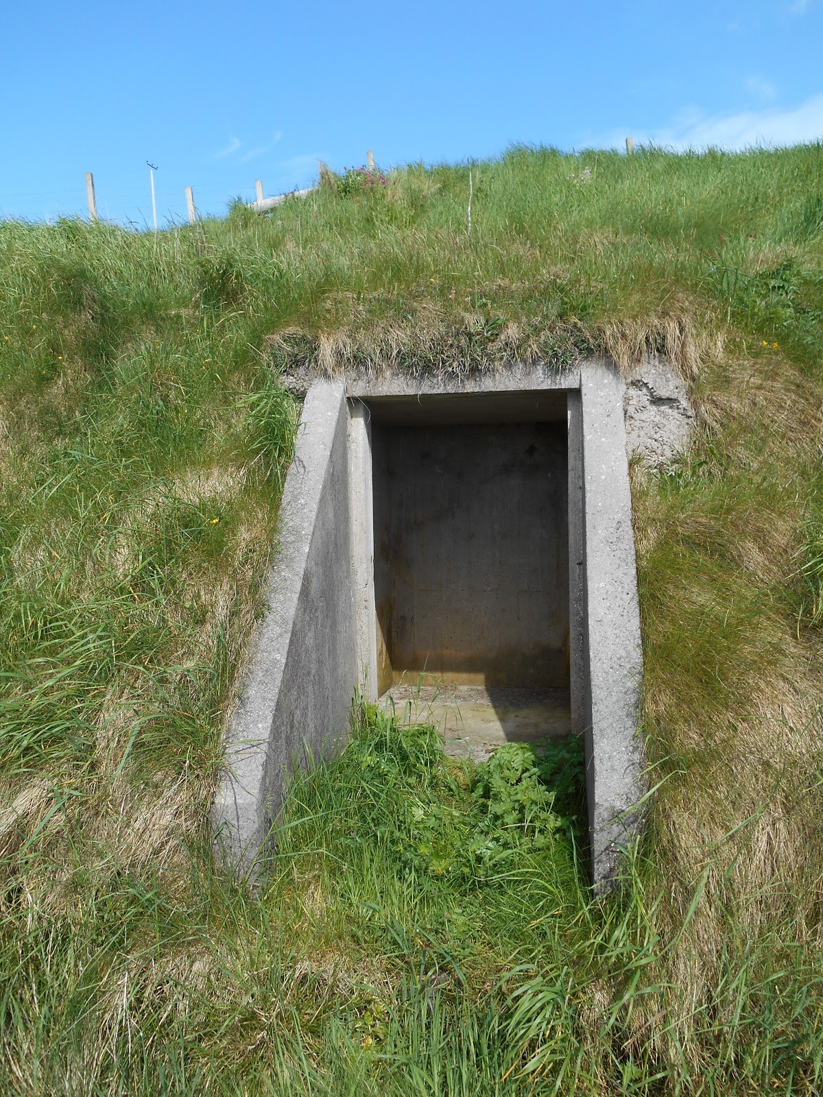
Second World War Lookout at Coubal - looking out over the Bay of Scousburgh
This is to be found on the east side of the B9122. Grid reference: HU 376 184
World War 2 lookout at Coubal
Prince Olav Slipway, Scalloway
The Shetland Bus was an operation using fishing boats, which sailed between Shetland and Norway during the Second World War, to assist the Norwegian resistance in their fight against Germany, which had occupied Norway in 1940. They took secret agents, radios, arms and ammunition to Norway and returned to Shetland with refugees. A base was set up in Lunna on the NE coast of Shetland Mainland in 1941 but it was moved to Scalloway in 1942. A slipway was built in Scalloway to repair and service the boats. It was named after Olav, Crown Prince of Norway and he paid a visit to Scalloway in October 1942. Many of the fishing boats were captured, sunk or lost in bad weather, so frrom November 1943 until the end of the war, three US Navy sub-chasers were used instead of fishing boats.
Prince Olav Slipway, Scalloway
Lighthouse at Point of the Pund, Scalloway
Memorial at Tingwall to Alan Young, a Loganair Air Ambulance pilot who was killed in a crash in 1996
Captain Alan Young's memorial plaque at Tingwall
Burial aisle of the Mitchells of West Shore in the graveyard of St Magnus's Church, Tingwall
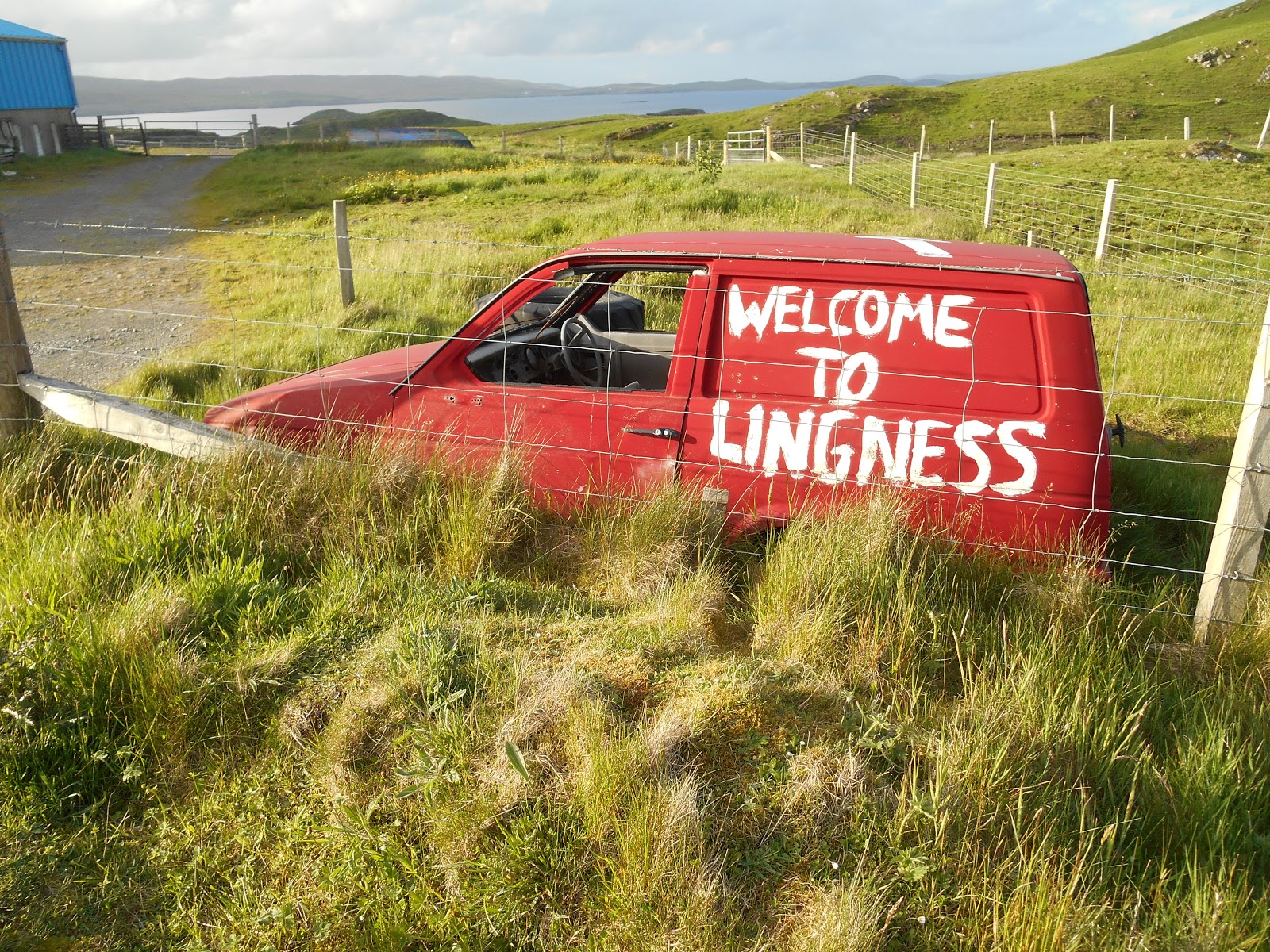
Notice at Lingness - what's a dug?
Unusual welcome sign at Lingess, South Nesting
Puffins on the wall at North Roe School
The Nort Trow Community Garden at North Roe was originally built as a graveyard. However after a few bodies had been interred there, it was realised that the heavy clay soil made the site unsuitable to be a graveyard. The bodies were exhumed and reburied at Sandvoe. In the late 1990s the former graveyard was turned into a community garden. Interest dwindled after a few years but was rekindled in 2008 and since then the garden has been looked after and developed by a dedicated small group of volunteers. The garden is open to the public and is well worth a look around.
Nort Trow Community Garden
Nort Trow Community Garden
Nort Trow Community Garden
Nort Trow Community Garden
Nort Trow Community Garden
Fairy House, Nort Trow Community Garden
Nort Trow Community Garden
Nort Trow Community Garden
Fish sculpture, Voe
Rock People
These two "rock people" can be found on the road to South Voxter, just off the B9071 Voe to Aith road. They look like inuksuit, which the Inuit people of Arctic North America build as landmarks.
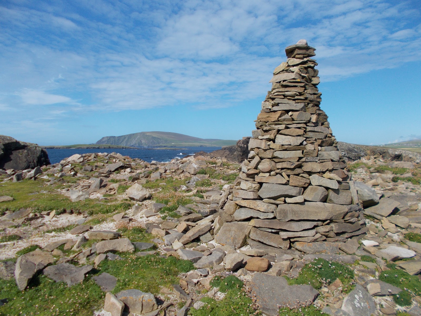
Lokati Kame
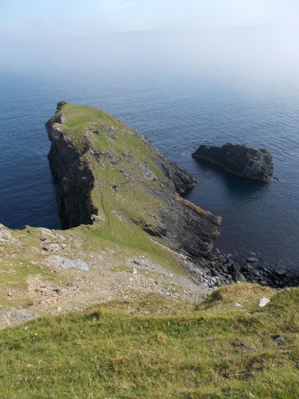
This narrow peninsula and adjacent stack are located on the coastal footpath to Fethaland.
Wick of Breibister
Gunnister Man's Grave
This is located on the unclassified road to Nibon, about 500 metres north west of the junction with the A970. The grid reference is HU 330 732.
Information notice at the Gunnister Man's Grave
Ruined watermill at Lera Voe
Ruined watermill at Skellister
Fish mosaic, New Street, Scalloway
Stone plaque on a house in New Street, Scalloway
The worn inscription on the plaque is a theory about what causes the tides on earth. It was apparently made by local stonemason and amateur scientist William Johnson in 1910.
Cutch kettles, Scalloway
These were originally used to preserve the sails and nets of fishing boats using bark from an Asian tree.
Fish railings, Scalloway
Scal-Air model plane, Scalloway
Scal-Air Departure Lounge, Scalloway
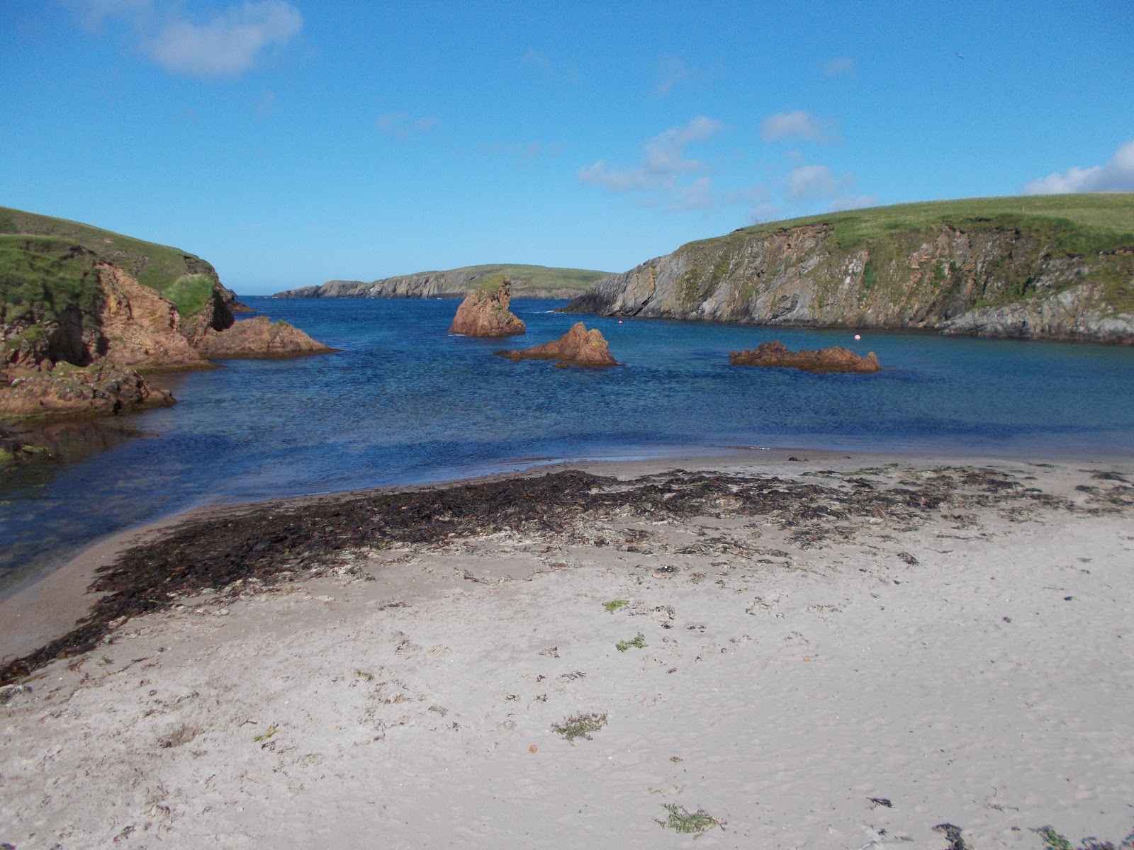
Beach at Spiggie with a view to the island of Colsay
Ness of Burgi
It is a mile from a small parking area at the end of the road in the village of Scatness south to the Ness of Burgi. The first part of the walk is very easy, then there is a storm beach to cross, followed by a very narrow rocky section but there is handrail at this point. The storm beach and the cliffs are stunningly beautiful and on the headland there is an Iron Age blockhouse fort to explore. The grid reference is HU 387 084.
Storm beach near Ness of Burgi
Rocky section of the footpath to the Ness of Burgi - with a handrail
Horse Island from Ness of Burgi
Cairn at the Ness of Burgi with Fitful Head in the background
Iron Age blockhouse fort on the Ness of Burgi
Horse Island from the Iron Age blockhouse fort on the Ness of Burgi
Ness of Burgi with Horse Island in the distance
Stone erected by the side of the road at Scatness by Italian prisoners of war in 1945 to thank the people of Scatness for their kindness
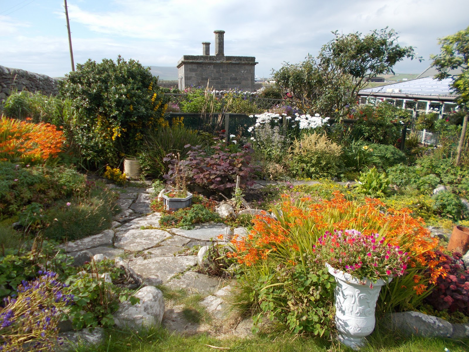
This beautiful walled garden in Grutness was open to the public to raise money for charity on the day I visited in late August 2019. It is the private garden of a lady who died recently. I cannot find any mention of it online but it is well worth a visit. It has been designed as a series of different "rooms" and is mainly a flower garden.
Grutness Garden
Grutness Garden
Grutness Garden
Grutness Garden
Grutness Garden
Stained glass windows in the Northlink Ferry Terminal, Lerwick
If you arrive/depart from Shetland by air or with a car, you are unlikely to see these lovely stained glass windows, which are on display in the main hall of the ferry terminal at Holmsgarth.
Stained glass window in the Northlink Ferry Terminal, Lerwick
Puffin and Lighthouse mural, Lerwick
Memorial to the Delting Fishing Disaster at Mossbank
22 local fishermen died on 21st December 1900 when they were caught in a sudden and severe gale 20 miles out to sea while fishing for haddock.
Unusual sign, Lerwick
Catfirth Air Station Memorial and Information Board
Catfirth Air Station was built in the winter of 1917. Seaplanes based here patrolled the eastern side of Shetland tracking and attacking German U-boats. It was the site of the first flight to Shetland c8th June 1918. The base was never finished, as the First World War ended in November 1918 and the base closed in April 1919.
Quendale Haa
Darth Vader
This chap can be found on the road between Grutness and Sumburgh Head.
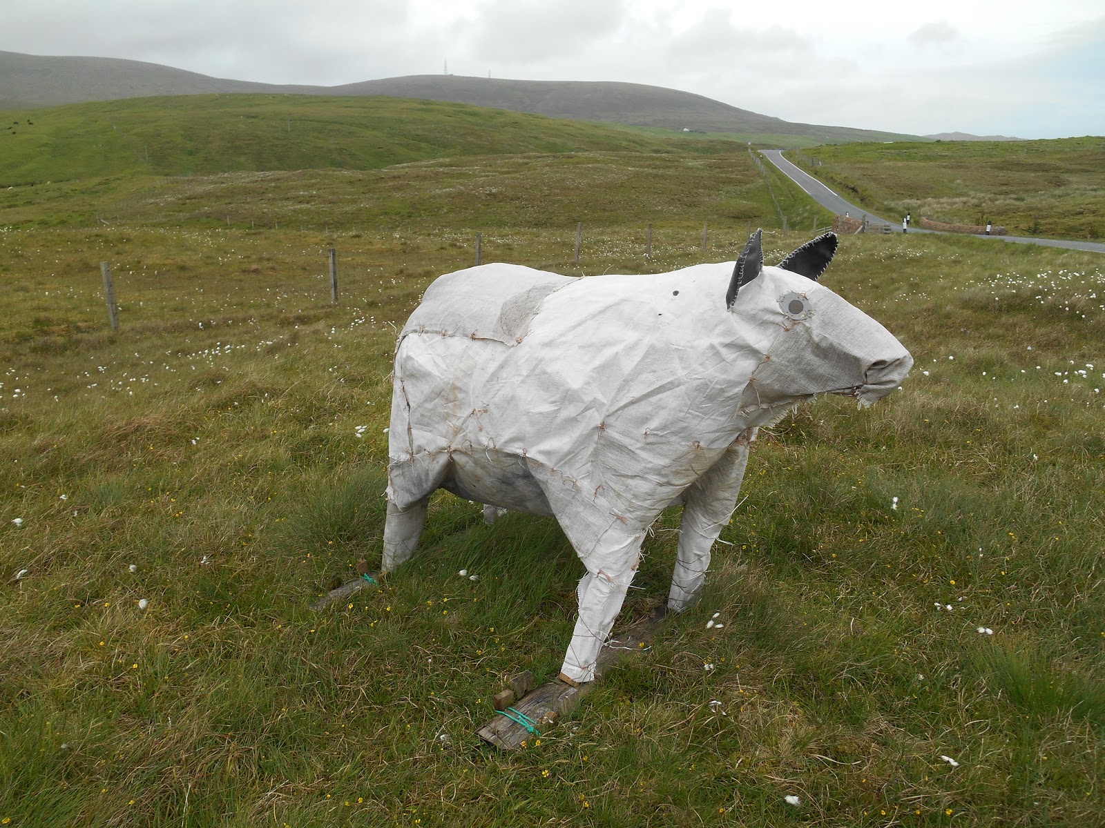
Sheep sculpture
This chap is located on the A970 in Northmavine, a mile north of Eela Water. I have no idea what he is doing there but he has been there for several years.
Grid reference HU 33812 80896
Boat seat, Hillswick
The Cake Fridge, East Burra Firth, Aith
The Cake Fridge started as an open all hours point of sale for home made cakes and bakes but the owner has now opened a café in the house next to the fridge.
Hollander's Knowe near Lerwick
This is a mound near Lerwick where Dutch people met to do business transactions. It is also where, according to legend, a woman heard fairy music.
Unlikely sign to find on a largely treeless island!
This sign is to be found on the road from Vidlin to Lunna
Burn of Weisdale, Kergord
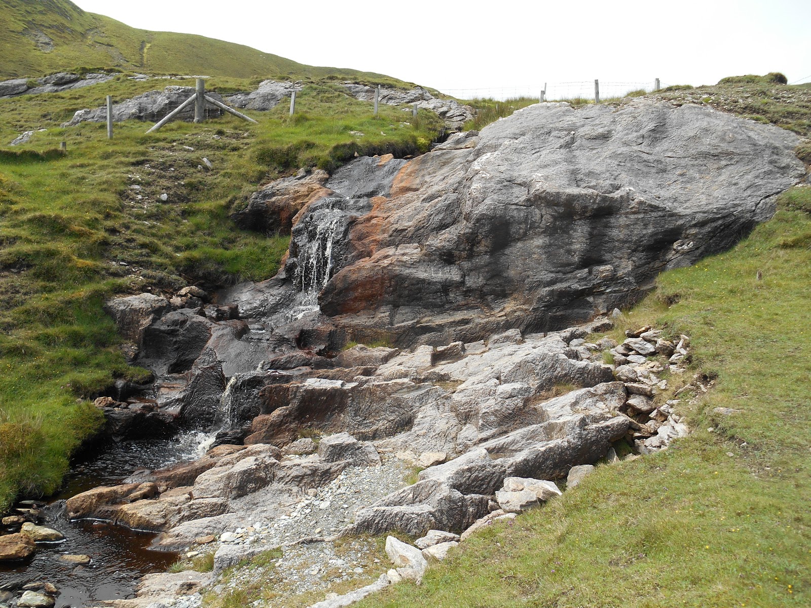
Burn of Lunklet, East Burra Firth
There is a well surfaced footpath leading up the Burn of Lunklet to this waterfall from the B9071 road at the eastern end of East Burra Firth. There is a small car park a short distance from the start of the footpath. The grid reference for the waterfall is HU 370 574
Quoys Burn, South Nesting (with a tree)
Kergord Plantations at Weisdale
These are the only mature plantations on Shetland and the tallest trees on the archipelago. There are 7 woods, which cover about 9 acres. They were planted by Dr George Munro between 1913 and 1920 to act as shelter belts. The species planted included sycamore, spruce and larch.
Park Hall, Effirth near Bixter
This derelict house was built c1900 using a poured concrete method of construction. It is a listed building.
Memorial to Ove Joensen at Aith Harbour
Sandness
Sandness is at the western end of the A971 road about 7 miles west of Bridge of Walls. It is well worth the drive, as there is a wide bay giving good views of Papa Stour and a signed walk along the shore.
Geology
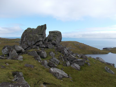
The Stones or Stanes of Stofast are a 2,000 tonne glacial erratic boulder, which has been split in two by the action of frost. They are located just over half a mile from the unclassified road that runs from Lunna to Outrabister. The start of the "footpath" is signed from a couple of laybys on the road. However the path doesn't exist for most of the way and it is VERY boggy. You cannot walk in a straight line if you don't want to get wet feet. There is a stile across a fence about half way there but it is easy to miss, given the lack of a path to follow. The views from the stanes are excellent. Grid reference: HU 510 716
Stones of Stofast
Stones of Stofast
Three unusual white boulders, Scalloway
Walls Boundary Fault
A section of the Walls Boundary Fault can clearly be seen at the beach at the Back of Ollaberry. This is part of the Great Glen Fault, which extends as far as the west coast of Scotland and is the best exposure of a major shear fault in Britain. The rocks on opposite sides of the fault have moved long distances in relation to each other. The major episodes of activity were in the Devonian (370 million years ago) and Middle Jurassic periods (170 million years ago). The headland on the east side of the bay is composed of granite, while the area to the west is schist, which is weaker than granite and has eroded away to form the bay. It is only a short walk to Back of Ollaberry Beach from Ollaberry Church but it isn't signed. The grid reference is HU 372 810.
Walls Boundary Fault, Back of Ollaberry
Walls Boundary Fault, Back of Ollaberry
Soapstone or steatite is a type of metamorphic rock. In Shetland it is known as cleber or kleber. Soapstone has a high talc content and is therefore soft and easy to carve. However it can be heated and cooled without shattering and it hardens when exposed to air or heat. Soapstone has been mined at Catpund since prehistoric times but it was the Vikings who made best use of the resource. It was used to make vessels of all shapes and sizes and at various times in history it was also used to make oil lamps, beads, spindle whorls, fishing weights, line sinkers, hearth backing, fire bricks and as a stain remover for woollen clothes. There are more than 20 places on Shetland where soapstone can be found. The majority of these are on Unst, Fetlar and in North Mavine. The Catpund soapstone quarry can be visited by parking in a large layby to the south of Mail in South Mainland and walking west up the Burn of Catpund. There is however no sign to it, although there is an information board when you get there. Chisel marks, blanks for bowls and waste chippings can all be seen. The grid reference is HU 424 270.

Soapstone quarry, Catpund
You can clearly see where bowls have been cut out of the rocks.
Soapstone quarry and the Burn of Catpund