Monday, 25 November 2024

Island 524 - Little Island, Guernsey

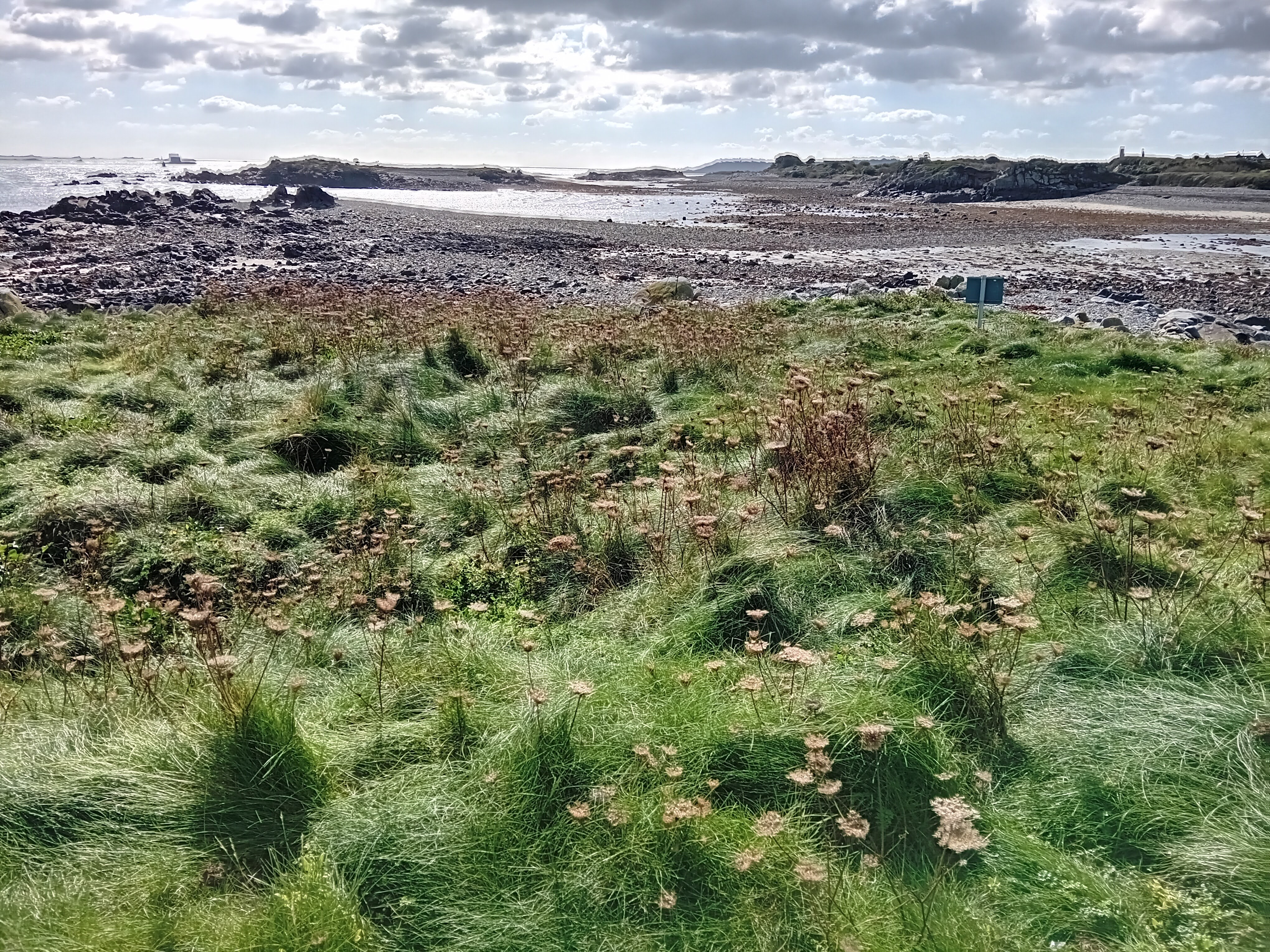
Little Island is a small, uninhabited tidal island and is located at the southern end of Port Soif on the west coast of Guernsey.  It is separated from Guernsey by a gap of about 50 metres and is covered in grass.  Thrift and autumn squill grow on the island.

Little Island from Port Soif

Looking north from Little Island

Little Island

Port Soif from Little Island

Le Nic au Corbin from Little Island

Monday, 18 November 2024

Island 523 - Noir Hommet, Guernsey

Noir Hommet/Houmet is a very small tidal island located at the southern end of the Baie des Pêqueries on the west coast of Guernsey.  It is separated from Guernsey by about 200 metres of boulders. Grass, rock samphire, autumn squill and thrift grow on the island.

Noir Hommet

Baie des Pêqueries from Noir Hommet

Noir Hommet

Tuesday, 5 November 2024

Island 522 - Cliff Rock, Guernsey

Cliff Rock is a very small uninhabited tidal island located at the north end of the Baie des Pêqueries off the west coast of Guernsey.  It is separated from the mainland of Guernsey by a gap of about 25 metres, which is covered in small boulders. The island is dominated by a very large rock formation.  The rest of the island is covered with grass.

Rocky outcrop on Cliff Rock

Looking north from Cliff Rock

Looking south from Cliff Rock

Looking west towards Cliff Rock

Saturday, 2 November 2024

Island 521 - Houmet Paradis, Guernsey

Houmet Paradis is an uninhabited tidal island located off the north east coast of Guernsey between Miellette Bay and Petils Bay.   Part of the island has been quarried at some point in the past.  It has also been used for gutting fish and grazing cattle.  Houmet Paradis is mainly covered in grass and bracken.

In Victor Hugo's novel The Toilers of the Sea, the hero of the book Gilliatt commits suicide at Houmet Paradis by drowning himself.

The island was previously known as Houmet de L’Eperquerie, but the name was changed when it was bought by the Collas family, as their estate was at Paradis.

In 1951 James Watson from Newcastle-upon-Tyne purchased the island for £500.  In 2004 his grandson sold it to an anonymous group of Guernsey islanders, who wanted it to become a nature reserve managed by the National Trust for Guernsey.  Sea birds nest on the island and visitors are requested not to visit the island, apart from the central path, between 1st March and 31st July each year.

Notice with access restrictions during the bird breeding season

Central path with ruined building

Petils Bay from Houmet Paradis

Separate part of Houmet Paradis

Old quarry on Houmet Paradis

Jethou and Herm from Houmet Paradis

Jethou and Herm from Houmet Paradis

Friday, 25 October 2024

Island 520 - Hommetol/Omptolle, Guernsey

Hommetol/Omptolle/Homptole/Hommeril/Houmet Hommetol is a small uninhabited tidal island located 250 metres off the east coast of Guernsey at Miellette Bay.  It is covered in very springy grass with lots of small holes in it.  Sea campion, sea beet and thrift also grow on the island.  Sea birds breed on the island and therefore access to it is not allowed between 15th March and 15th July. The area around the island is apparently noted for the collection of ormers, which are a member of the abalone family.  I'm not sure how such a small island came to have some many different spellings of its name!

Omptolle from Petit Omptolle

Herm from Hommetol

Beaucette Marina from Hommetol

Sea beet on Hommetol

Notice restricting access to the island during the bird breeding season

Houmet Paradis from Hommetol

Wednesday, 16 October 2024

Island 519 - La Vieille, Guernsey

La Vieille is a very small uninhabited tidal island located 150 metres off the east coast of Guernsey at Petils Bay.  It has barely enough vegetation to count as an island.  Plants on the island include thrift and rock samphire.  The rocks are covered in golden, grey and green lichens.

Houmet Paradis from La Vieille

Houmet Benest from La Vieille

Petils Bay from La Vieille

Jethou and Herm from La Vieille

Friday, 11 October 2024

Island 518 - Houmet Benest/Houmet Benêt, Guernsey

Houmet Benest/Houmet Benêt is a small uninhabited tidal island located about 100 metres off the north east corner of Bordeaux Harbour on the east coast of Guernsey.  It is covered in grass, bracken, brambles, rock samphire, sea campion, thrift and gorse, but there are no trees.  When I visited in October 2024 I saw 4 wall butterflies, which is more than I have ever seen in one place before.  In the 18th century a gun battery was built on the island and a few remains of this can still be seen. I came across a stone with S4 carved on it.

Sea campion and gorse on Houmet Benest

Houmet Benest

La Vieille from Houmet Benest

Stone with S4 carved on it

Houmet Paradis from Houmet Benest

Hommet from Houmet Benest

Bordeaux Harbour from Houmet Benest

Thursday, 10 October 2024

Island 517 - Hommet, Guernsey

Hommet is a very small tidal island located close to the north coast of Bordeaux Harbour on the east coast of Guernsey.  On most maps it is shown as a peninsula, but there is definitely an area of about 20 metres of sand and pebbles between the Hommet and mainland Guernsey, which covers at some high tides.  The island is covered in grass, thrift and brambles and there is one small tree growing on it.

Hommet from Bordeaux Harbour

Bordeaux Harbour from Hommet

Bordeaux Harbour from Hommet

Hommet Benest from Hommet

Herm and Jethou from Hommet

Friday, 23 August 2024

Island 516 - Sunk Island, East Yorkshire

Sunk Island is located on the north bank of the Humber estuary and two miles to the south of the village of Otteringham in East Yorkshire. It is owned by the Crown Estate.  At the time of the 2021 census the population of Sunk Island was 221.

Sunk Island started life as a sand bank, which appeared in the late 16th century.   By the mid 17th century the sandbank was 7 acres in size.  It was claimed as crown property and leased to Colonel Anthony Gilby, who died in 1682.  He started the process of reclaiming it from the sea.  His descendants continued the process of embanking and draining and by 1850 the island had an area of 5000 acres. The current area of Sunk Island is 4,575 hectares (11,305 acres).  Nowhere on Sunk Island is more than 4 metres above sea level. The land is almost all in use for growing arable crops.  The houses and farms are scattered around the island.

Sunk Island is no longer a true island.  Until the late 17th century it was separated from the mainland of East Yorkshire by the North Channel. Then the western end of the North Channel silted up and the lack of flowing water caused the North Channel to silt up even more.  The Winestead Drain is a river, which has its source near Withernsea and flows into the North Channel a mile to the west of Patrington Haven.  In 1819 the Winestead Internal Drainage Board installed a sluice on the North Channel and the eastern part of the North Channel was renamed the Winestead Drain.

Prince Albert commissioned the Gothic Revival architect Samuel Sanders Teulon to design and build about 30 cottages and farmhouses on Sunk Island.  These were built 1855-57.  He also designed the school. The school closed in 1969.  

The Church of the Holy Trinity is located in the middle of the island and adjacent to the old school, postbox and telephone box.  The red brick church was designed by Samuel Sanders Teulon, but he died in 1873 before it was finished. It was completed in 1877 by his friend and fellow architect Ewan Christian.  The church was declared redundant c1983 and is now used as a heritage centre.

In 1908 Stanley Duncan (1878-1954) founded the Wildfowlers Association of Great Britain and Ireland (WAGBI) at the "Black Hut, which was located close to Outstray Farm at the east end of Sunk Island by Winestead Drain.  In 1981 WAGBI became the British Association for Sport and Conservation (BASC).  In 1994 a monument to Stanley Duncan was erected at the end of the public road next to Outstray Farm by the Hull and East Riding Wildfowlers Association and the Holderness and Humber Wildfowlers Association.

There is a Greenwich meridian marker located on the sea wall just over half a mile south of Outstray Farm. It was erected in 1984, but was moved 130 metres north when the sea wall was realigned in 2006 to create a 54 hectare intertidal wildlife site to compensate for the loss of habitats, due to the increase in size of the ports of Hull and Immingham.

There is a disused Ground Control Interception (GCI) radar station on the opposite side of the road to Bleak House Farm Cottages half a mile south west of Patrington Haven.  This was built as part of RAF Patrington during the Second World War (c1942) to detect, locate and track enemy aircraft.  It has a stand-by set house and a large operations block, which was known as the Happidrome. The domestic accommodation for RAF Patrington was at Patrington Haven on the north side of Winestead Drain.  The radar station was in use until 1955.

Sunk Island sign

Church of the Holy Trinity

War Memorial, Telephone Box and Postbox

Signpost

Giant gecko on house

Houses on Village Road

VR & AR1855
 Plaque above the door of a cottage on Channel Road
VR = Queen Victoria & AR = Prince Albert

Cottage on Channel Road

A typical Sunk Island view

Typical Sunk Island view of arable fields


Gate to nowhere on Stone Creek Road

WAGBI Monument at Outstray Farm

WAGBI logo on monument

Old Radar Station close to Bleak House Farm Cottages