Wednesday 20 June 2012

Island 170 - Sully, Glamorgan, South Wales

Sully Island is a low lying tidal island about 500 metres south of the hamlet of Swanbridge, which is itself located about a mile to the south east of the small town of Sully.  It is only accessible for a few hours either side of low tide and the tidal currents in this area are very strong, so a check of the tide times is essential before venturing across the rocky causeway.  The highest point on the island is only about 24 metres above sea level.  There was once a fort there but I could see no signs of it.

This is the tidal island with the most warning signs I have come across so far.  The first notice said the beach was dangerous because part of the sea wall has collapsed and there are lots of chunks of concrete, some with metal rods sticking out of them, strewn across it.   However it was easy enough to find a way round them.  The second notice says the causeway is a death trap, presumably because of the tidal currents, because when the tide is out the walk across the causeway is very easy -  there isn't much seaweed on it, the rock bedding planes are almost horizontal and apart from skirting round a few small rock pools there aren't any other hazards.  When you get to the island there is another notice saying you have risked your life to visit. 

On a sunny summer day Sully Island was a lovely place to spend a while wandering around.


 Warning at Swanbridge

Causeway from Swanbridge to Sully Island  


When you arrive on the island there is another notice saying you have risked your life to visit the island.

 
 Highest point on the island with Steep Holm in the distance
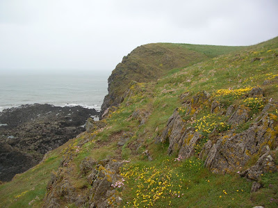
I'm not sure what the yellow flowers are - they looked like members of the buttercup family

 
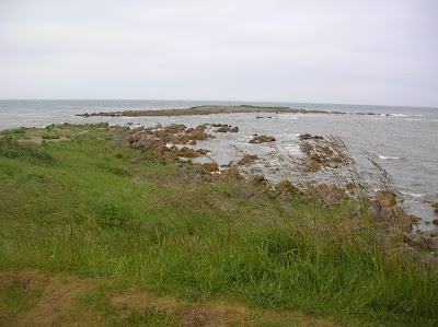
 South Coast with Flat Holm and Steep Holm in the distance
 
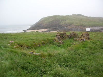
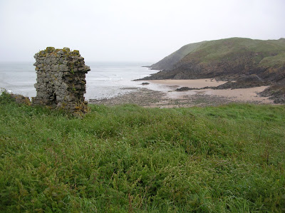
 Swanbridge from Sully Island

There are several paths crisscrossing the island.  Some areas are covered with grass and bracken with wild flowers like bird's foot trefoil, cowslip and salad burnet.  The rest is covered by thick scrub e.g. elder bushes and brambles.  The low lying part in the middle is covered with tall reeds.  The north side of the island, which is only a few metres above sea level, is fringed by a pebble beach.  On the south side there are low cliffs fringed by platforms of stone and large flat boulders.

  Interesting geology on the south coast - looking towards Barry
Triassic mudstones and sandstone with older limestone beneath

South coast with Steep Holm and Flat Holm in the distance

Sully Island was put up for sale in 2009 for £1.25 million but didn't sell.  In 2011 the price was reduced to £95,000 and it was sold to a mystery buyer.

Tuesday 19 June 2012

Island 169 - Mumbles Head, Swansea, Wales

Mumbles Head is a small rocky island located 100 metres to the south east of Middle Head and about 300 metres south east of the mainland.   It is separated from Middle Head by a tidal channel called Outer Sound.   It is accessible for no more than about 2 hours either side of low tide across a rocky and sandy beach.  The island rises to a height of 22 metres and there are concrete steps all the way from the beach to the summit.

The main feature on the island is the lighthouse.  There are also the remains of lookout posts and buildings from various wars since 1860.  Wildflowers like thrift and birds foot trefoil were flowering in abundance when I was there in June 2012.  I had the island to myself, which is always a good feeling, although there were some men looking for something (shellfish?) on the nearby beach.  Islands with lighthouses always rank highly in my estimation and Mumbles Head Lighthouse has an unusual but aesthetically pleasing design.

The lighthouse was designed by local architect William Jernegan and was completed in 1794.  It was put there to warn ships away from Mixon Shoal half a mile to the south.  It originally had 2 open coal fired lights, one above the other, to distinguish it from St Ann's Head and Flat Holm Lighthouses.    This is why it is such an unusual shape.  The coal fired lights were replaced in 1799 by an oil powered light.   It was automated in 1934.  The lighthouse was originally built by the Swansea Harbour Trustees.  In 1975 responsibility for it passed from the British Transport Docks Board to Trinity House.  In 1995 it was converted to solar power.

 Mumbles Lighthouse

 Mumbles Lighthouse
 - looking beautiful silhouetted against a cobalt blue sky

 Wartime Lookout on Mumbles Head

 Mumbles Head and Middle Head from Bracelet Bay


Mumbles Head from Middle Head
A few more minutes to wait before the causeway is clear of water.
 
Looking towards Middle Head and Mumbles Pier.


Waiting for the tide to go out - Middle Head with Mumbles Head beyond

Monday 18 June 2012

Island 168 - Middle Head, Mumbles, Swansea, Wales

Middle Head is a grass covered rocky tidal island located 100 metres to south east of Mumbles Pierhead.  It is separated from the mainland by a tidal channel called Inner Sound.  It is accessible for just over 2.5 hours either side of low tide.  I found the easiest access on to it to be on the Mumbles Lighthouse side, although you do have to scramble over a few large boulders to access it whichever route you choose.  The tide clears from Middle Head about an hour before it clears from Mumbles Head.  The island had a geocache at the time of my visit in 2012 and is covered in wildflowers e.g. thrift, birds foot trefoil, kidney vetch, thrift, buttercups and salad burnet.   There are a few scrubby trees on the more sheltered eastern side.

There is a notice at the pier telling you not to walk out to the islands because of the tidal currents, which I could see were very strong, as I arrived 2 hours early and had to wait for the tide to recede.

 Highest point on Middle Head

 Mainland from Middle Head

 Middle Head and Mumbles Head

Mumbles Pier from Middle Head

Island 167 - Port Eynon Island

Port Eynon Island is a low lying and very small tidal island located to the south of Port Eynon village and youth hostel.  I only knew the island was here because it has a geocache on it.  It may be called Skysea or Sedgers Bank - it is difficult to tell on the 1:25,000 scale map whether these names refer to the island or nearby rocks.  The island is treeless and has just about enough grass to graze a very small sheep.  It is easily accessed across 100 metres of sand and small rocks.  It is covered in grass and wildflowers like thrift and bird foot trefoil.  The island is only cut off for an hour or 2 either side of high tide.  The island is a Site of Special Scientific Interest and I think it is owned by the Wildlife Trust of South and West Wales.

 Port Eynon village from Port Eynon Island

 Looking south out to sea

 Port Eynon village from Port Eynon Island

 Port Eynon Island from the hill above

High tide

Island 166 - Burry Holms, Gower, Wales

Burry Holms is a small tidal island at the north end of Rhossili Bay, which is at the western end of the Gower Peninsula in Wales.  It is accessible for about 3 hours either side of low tide and is approximately 500 metres x 250 metres.  I visited on a rainy day, so the views weren't great.  In fact I couldn't see as far as Worm's Head at the southern end of Rhossili Bay.  You can scramble over the rocks to the island or look for the easy rock-free path through the sand on the south east side of the island.  The island is located about 200 metres from the mainland.

The nearest parking is a mile and a half away at Hillend Burrows (fee) or Llangennith Burrows, Llangennith.  Alternatively you could park at Rhossili (fee) and walk north along the beach for 3 miles.   The sand is firm and therefore easy to walk on.

An Iron Age earthwork runs north-south across the island.  The ruins of a 14th century chapel dedicated to St Cenydd and a schoolroom can be seen at the eastern end of the island.

I visited on a Bank Holiday in June 2012 but had the island to myself apart from a lone fisherman on the rocks at the western end of the island, as it was pouring with rain and blowing a gale.  I don't know how the fisherman got down there and also don't know how he was managing to stand upright in the very strong winds.

The island is tree less and is covered with grass and wildflowers including thrift and birds foot trefoil.  I did see a lone orchid.  There are a few rocky outcrops on the island, which is crisscrossed by a number of paths.  I'm sure it is a lovely place to sit and stare or eat a picnic on a sunny day but as the weather was very inclement I didn't linger for long.


Iron Age Earthwork - looking north
 
 Remains of St Cenydd's Chapel

Burry Holms
 Remains of schoolhouse - looking north

 There is a lone fisherman on the far rock

Burry Holms from Rhossili Beach

Saturday 16 June 2012

Island 165 - Worm's Head, Gower, Wales

Worms Head is a long thin tidal island located at the south end of Rhossili Bay on the Gower Peninsula.  It has been owned by the National Trust since 1967.  It is accessible for 2.5 hours either side of low tide and the safe crossing times are displayed outside the National Coastwatch Institute Station at the top of the cliff.  It is about a mile level walk along a gravel path on top of the cliffs from the car park (charge) at Rhossili Bay and it takes 15-20 minutes to cross the rocky causeway.

I arrived too early and the causeway was only just beginning to clear, so I went and found a few geocaches and by the time I got back it was clear.  It isn't the easiest causeway to cross.  The hardest part is at the landward end where the rock strata is diagonal.  After that it is a question of picking a route around the rock pools.  Most of the rocks are free of seaweed and are covered in barnacles and small mussels.  The barnacles provide excellent grip, although it wouldn't be a soft landing if you fell on them.  As you approach the Inner Head it gets a bit harder once again.  The causeway is only about 500 metres long but depending on which route you take, you are likely to walk at least twice that to find a relatively dry crossing.  I was wearing walking boots and didn't get wet feet but if you were wearing trainers you would be lucky to get across with dry feet.

There were several people wandering about on the causeway but I had Worms Head to myself, which was surprising on a bank holiday weekend.  However it was wet and windy, so that might account for the lack of visitors!

Inner Head was covered with thrift, meadow cranesbill, kidney vetch, spring squill and birds foot trefoil, all of which were in flower.  

Low neck separates the Inner and Outer Heads.  Low neck is a causeway of very jagged rocks with no clear path through them.  I think it is above the level of high tide but I would think that in stormy conditions waves break over it, as it is devoid of vegetation.  From March to August - the bird breeding season - there is no access to the Outer Head to prevent disturbance to the birds.  There is a water spout on Outer Head.


 Outer Head and the Devil's Bridge - a natural arch


 Outer Head and the Devil's Bridge
 
 The rocky causeway is beginning to clear
 - just over 3 hours before low tide

Inner Head and notice warning of the dangers of getting cut off by the tide.

Island 164 - St Catherine's Island, Tenby, Pembrokeshire, Wales

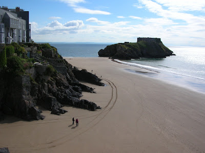
This small tidal island is very easily accessed across the golden sands of Tenby's South Beach for about 3 hours each side of low tide.  However currently it is only possible to climb up the first 20 steps before you reach a locked gate.   The island is approximately 200 metres by 100 metres in size.

There is a fort on top of the island which was built between 1867 and 1875  on the orders of Lord Palmerston to defend Milford Haven and Pembroke Dock from possible attack by the French.  The island was sold by the government in 1907 and then again soon after to the Windsor-Richards family, who turned the fort into a summer house.

In 1940 it was sold again and was unoccupied until it was sold in 1962 to a Tenby businessman.  The fort was a zoo from 1968-79.  The current owner is in dispute with the local council about how it should be developed, hence the current lack of public access.  I look forward to the time when it is possible to fully explore the fort.

St Catherine's Island

St Catherine's Island showing one of 3 short tunnels that run through the width of the island.

The tide isn't quite out far enough

St Catherine's Island from Castle Hill

Fort on St Catherine's Island from the Caldey Ferry

Fort on St Catherine's Island from the Caldey Ferry

This is currently as far as you can go

Tuesday 12 June 2012

Island 163 - Gateholm, Pembrokeshire, Wales

Gateholm is a tidal island located on the Pembrokeshire coast between Marloes Beach and Albion Sands.  It is approximately 600 metres long by 150 metres wide and covers an area of 20 acres.  Its relative dimensions and shape with steep sides and a flat top reminded me of smaller version of Lundy.

Before my visit in June 2012 I couldn't find much information about how accessible the island is.  I walked along the coast path to it from Marloes Youth Hostel but the path down is very narrow, steep and overgrown at this time of year.  The path comes down on the Marloes Sands side, so I then had to walk across some dry rocks and boulders and then 30 metres of slippery seaweed covered rocks over to the Albion Sands side from where I thought it would be easier to access Gateholm.  Albion Sands is a delightful beach and I had it to myself.  The walk across the sands to Gateholm is easy but the island is fringed by 35 metres of huge boulders many of which were covered with more slippery seaweed.  I was on my own and had no phone signal, so decided to go no further than the middle of the boulder field.  I would have liked to reach above the high tide zone but had I reached this I couldn't see a way up on to the flat top of the island, as the sides are very steep on all sides.

I don't know how people accessed it in the past but they obviously did, as there are more than 100 Romano British hut circles on the island and one book I read said sheep were grazed on it in more recent times.

In the early 18th century it was owned by Charles Philipps and it stayed in his family until the 1890s when it was sold to Lord Kensington.

Albion Sands and Gateholm

No way up here

Inaccessible Cliffs

Gateholm from the cliffs above Albion Sands

Gateholm Stack

Gateholm Stack

Albion Sands and Gateholm

Albion Sands and Gateholm with Skokholm in the distance


Gateholm and Marloes Sands with Skokholm in the distance

 
Gateholm from the cliffs above Marloes Beach with Skokholm in the distance