Showing posts with label Devon. Show all posts

Saturday, 2 December 2023

Island 514 - Drake's Island, Plymouth Sound

Drake's Island, which is also known as St Nicholas's Island, is located in Plymouth Sound 0.5 miles south east of Western King Point and a mile south west of The Hoe.  It has an area of 6 hectares and the highest point on the island is 25m above sea level.  

The island is made of Devonian limestone and fossilised rhyolite volcanic lava and ash (tuff or tufa).  Drake's Island was joined to Mount Edgcumbe on the Cornish coast until c3,000 years ago when sea levels rose after the last ice age and flooded the land bridge.

There was a chapel dedicated to St Michael on the island in the 12th century. Drake's Island used as a refuge by Protestants during the Prayer Book Rebellion of 1549.  The island was first fortified c1550 to safeguard the maritime approaches to Plymouth.  The chapel was demolished at this time and the stone was reused to build two artillery towers. 

The fortifications were upgraded c1601 by Federico Genebelli for Elizabeth I.  Barracks, firing platforms and store rooms were built on the top of the island and walls were built around the island's coast.

During the English Civil War of the 1640s Plymouth supported the Parliamentarians and the island played an important role in helping the city withstand a 4 year siege by the Royalists.

After the Restoration of Charles II in 1660, Drake's Island was used as a prison for 25 years.  Prisoners included Leveller Robert Lilburne and General John Lambert, both of whom died on Drake's Island.

The strategic importance of Drake's Island increased after the Royal Naval Dockyard moved from Cattewater to the Hamoaze (Tamar estuary) in 1691.  In 1715 or 1717 Colonel Lilley surveyed the defences on Drake's Island and reported that they were in a very poor condition.  In 1720 a guardhouse and barracks were built on the west side of the island. In 1780 the defences were modernised. A south facing battery was built on the top of the island.  A barrack block and officers' quarters were built constructed at the west end of the island. The barracks were upgraded and extended in the 1830s and 1840s.

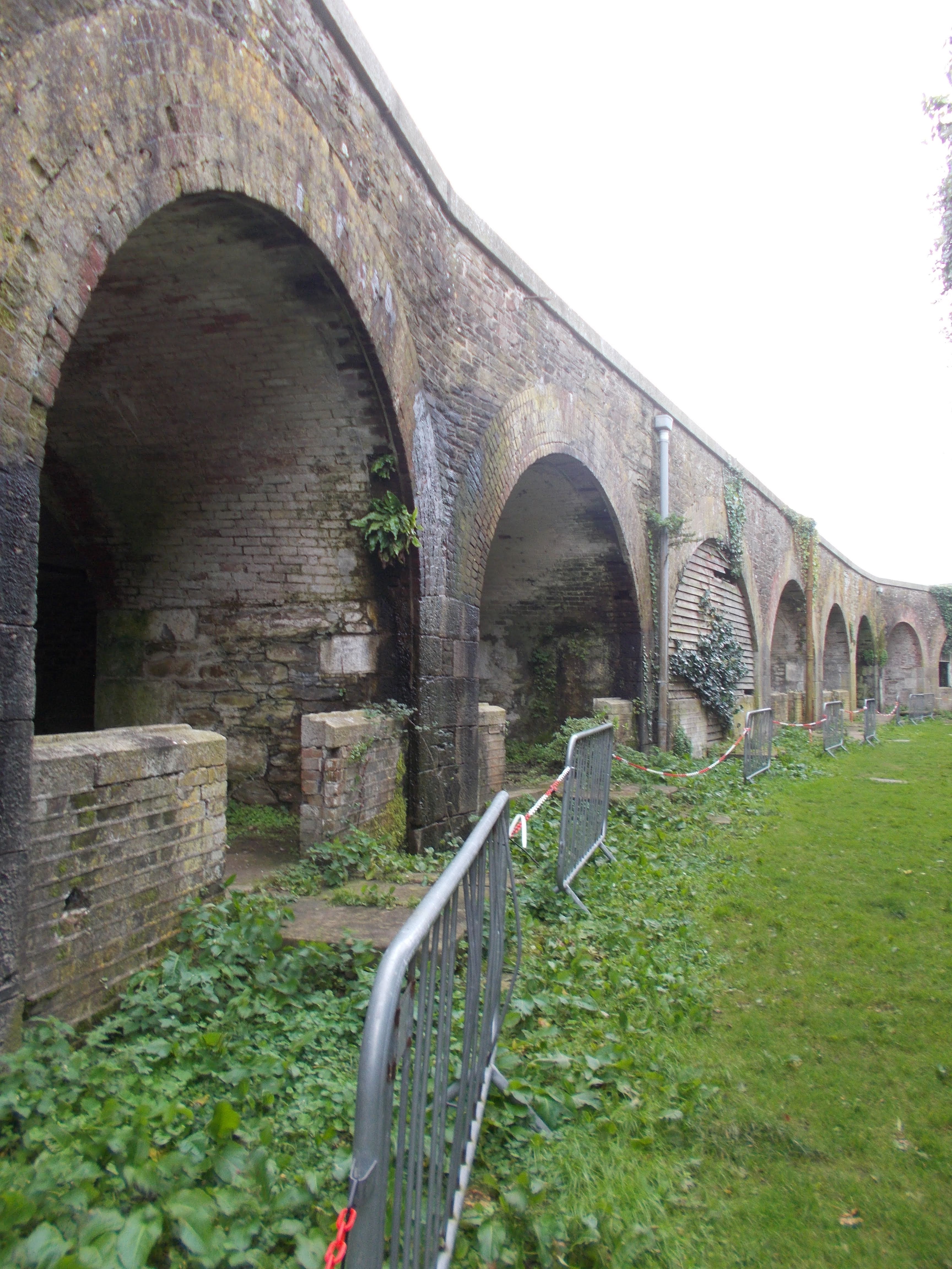
In 1860 work began on fortifications on the orders of Lord Palmerston.  An arc of 21 casemates were constructed on the south west side of the island for 9 inch 12 ton guns, along with a complex of tunnels and magazines. In 1870 five 12 inch 25 ton guns were delivered and hauled to the Upper Battery. From 1898-1901 three new batteries were built on Drake's Island - Eastern, Centre and Western Batteries

During the First World War Drake's Island had 9 guns in 3 batteries and a garrison of up to 300 men but the guns were never fired in anger.  Lady Nancy Astor opened a recreation hut for the soldiers on Drake's Island, which had been funded by her husband Waldorf Astor.

During the Second World War Drake's Island was equipped with guns and searchlights to protect the Royal Navy's base at Devonport from sea borne attacks.   The jetty, which is still in use, was built in 1939. Up to 490 men were stationed on the island but once again the main guns were never fired in anger, as the Germans attacked Plymouth from the air.

In 1961 the War Office handed Drake's Island back to the Duchy of Cornwall.  They leased it to the National Trust, then the Mayflower Trust and finally Plymouth City Council. It was run as an Adventure Training Centre from 1963 until 1989.  Trees were planted on the island during this period.  A mains water pipe was laid from the mainland to the island in 1964.

In 1996 Dan McCauley, businessman and former owner of Plymouth Argyle FC, purchased Drake's Island from the Duchy of Cornwall.  His plans to build a hotel and leisure complex on the island were turned down by Plymouth City Council.

Local businessman Morgan Phillips bought Drake's Island in 2019 and it is currently open for pre-booked guided tours in conjunction with Plymouth Boat Trips.  The ferry departs from the Barbican landing stage.  When I visited in September 2023 the guided tour cost £18 and the ferry was £7.50.  The guide who showed us round was excellent and I thought it was very good value for money.

Tudor wall on the north side of Drake's Island

Upper Battery - 25 ton guns

Palmerston era gun remounted

Upper Battery: Palmerston era guns

Casemates

Casemates

Casemates

Inside the casemates

Doorway to tunnel

Guardroom, Master Gunner's Quarters with the modern day toilets in front

Soldiers' Barracks

Ablution block and cook house

Jetty

1970s Boathouse in a very dilapidated state, with the Tudor fortifications behind it

Entrance gateway to the island

Stores underneath the western gun emplacement

Drake's Island Ferry

Barracks from the jetty
Drake's Island from the jetty

Officers' Quarters

Odd mural in one of the former magazines 
I was told this room was used as a bar during the Adventure Training Centre era


Steps down to the casemates

Ventilation shaft

Brittany Ferries' Pont Aven sailing by

Side of the Soldiers' Barracks

Guard Room and Master Gunner's Quarters

Centre Battery

Saturday, 16 July 2022

Island 497 - Hamator Rock, North Devon

Hamator Rock is a small rocky tidal island separated from the coast of North Devon at Broadsands Beach between Watermouth Bay and Combe Martin by about 50 metres of water at high tide. It isn't named on the current small scale Ordnance Survey maps but it is on the 1886 edition of the 25" = 1 mile scale map.  The rock beyond it is called Inner Stone and the one beyond that is Outer Stone. They are all composed of Middle Devonian sandstone.

To access Broadsands Beach you have to go down c240 steps.  When we first tried to access it in December 2020, the path was shut because some of the steps were damaged but that section has now been replaced.  Once on the beach, as long as it is at least a couple of hours after high tide, it is an easy stroll to the bottom of the island.  There are a couple of routes to the top but the path is steep and coming down is always scarier than going up, so I only went part of the way up.  The island has a row of trees growing on the top of it and the rest of the island above high tide level is covered in grass and scrub.

When we visited in April 2022, fulmars were sitting on some of the rocky ledges on the south side of Broadsands Beach.

Hamator Rock

Looking north towards Hamator Rock

Hamator Rock and Broadsands Beach

Hamator Rock with Inner and Outer Stone beyond it

Halfway up Hamator Rock

The beginning of the path to the top from the high tide level

Broadsands Beach from Hamator Rock

Lester Point and Little Hangman from Hamator Rock

Combe Martin Bay with Little Hangman in the distance

Looking west up Hamator Rock

Little Hangman from Hamator Rock

c240 steps up from the beach to the cliff top

Monday, 3 May 2021

Island 488 - David's Stone, North Devon

David's Stone is a small rocky uninhabited tidal island located on the North Devon coast at David's Hole half a mile to the west of Combe Martin.  David's Hole is signposted as Mermaid's Cove, although this name is not shown on any Ordnance Survey maps, so I presume it is either what the locals call it or it was a name invented by the owners of the Sandaway Beach Holiday Park, which is located on the cliff top above the beach, to make it sound more appealing.  It says on their website that it is their private beach but there is a public footpath, which runs from the South West Coast Path in a north westerly direction along the boundary of the holiday park and then through the northern part of it and down the steps to the beach.  However when we visited in December 2020 the section of the public footpath that runs along the boundary was barely accessible - we had to crawl under 3 trees that had fallen across it and fight our way through brambles. Devon County Council have assured us that the footpath will be cleared by spring 2021.

David's Stone has several trees and gorse bushes growing on the summit of the island.

David's Stone from across the beach at David's Hole

Looking up towards the summit of David's Stone

David's Stone from the footpath down to the beach

David's Stone

Looking east from David's Stone towards Lester Point and Little Hangman

David's hole from David's Stone

The beach at David's Hole aka Mermaid's Cove

Wednesday, 28 April 2021

Island 487 - Crow Point, Braunton, Devon

Crow Point is a sand spit, which is also a tidal island at the moment, although it is only cut off at spring tides.  It is a comparatively recent island, as a shingle spit, known then as Crow Neck, only started to form across the Taw estuary c1840.  The reasons for its formation were probably:
  • Fish weirs, which were constructed in the intertidal area around Crow Point in the mid 19th century.  These obstructed the flow of the tide and caused the deposition of sand and shingle.
  • Horsey Island was enclosed in 1857, which altered the course of the River Caen.  Before this time it flowed along the northern side of the island and probably provided enough water to keep the area where Crow Point now is, clear of excess sand.
By 1900 sand dunes had begun to form on top of the spit. In 1921 the spit was breached and Crow Point became an island.  Then for the next 25 years or so sand was gradually deposited on Crow Neck and by 1946 it was c60 metres wide and marram grass had established itself on the island.

The gap between Crow Point and Braunton Burrows is currently protected by a low line of rock armour.  A 2013 report commissioned by the Environment Agency and Torridge District Council says that the existing rock armour will fail at some point after 2025 if it is not maintained. Experts disagree what the result of this failure will be on Crow Point.

Crow Point Lighthouse was built by Trinity House in 1954 to guide ships and boats sailing up and down the Taw and Torridge estuaries.  It was originally powered by acetylene gas but was converted to electrical operation in 1978 and solar power in 1987.  The light is 7.6 metres above mean high water level.

Crow Point Lighthouse

Crow Point Lighthouse

Crow Point Lighthouse

The gap between Crow Point and Braunton Burrows

Looking NW up the landward side of Crow Point

Looking SE down Crow Point

Crow Point Lighthouse from the top of Crow Point

Crow Point Lighthouse

Common restharrow

Crow Point Lighthouse from the top of Crow Point

Memorial? on the top of Crow Point

Six-spot burnet moth on viper's bugloss

Appledore from Crow Point